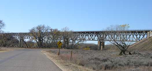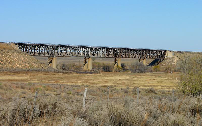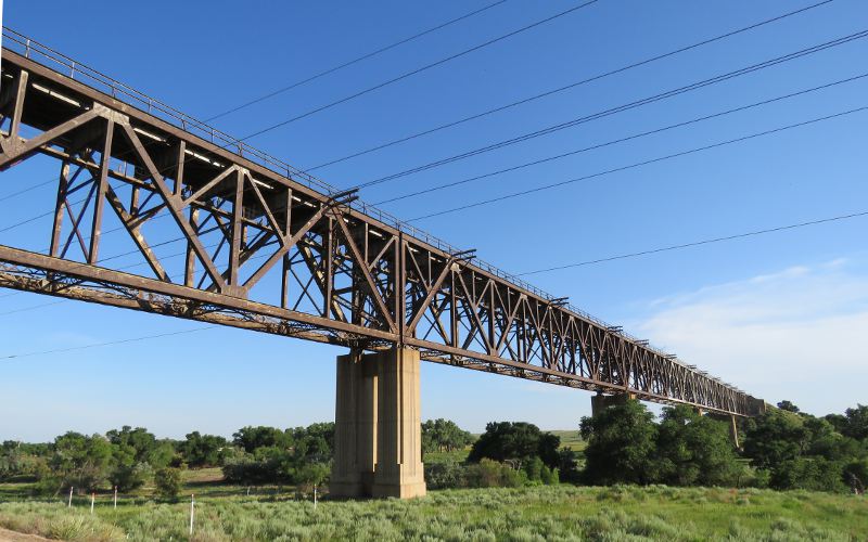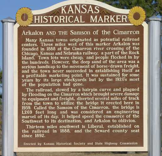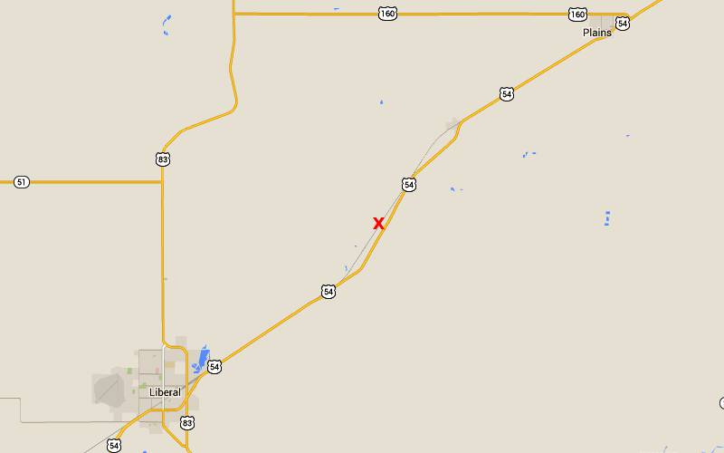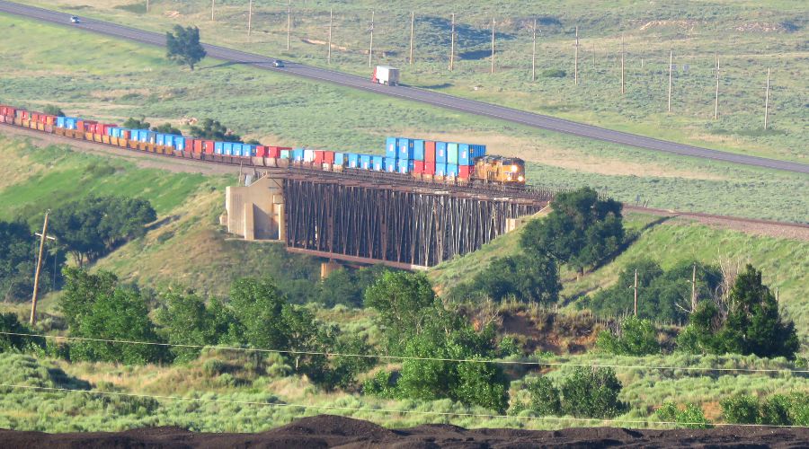
Mighty Samson of the Cimarron - Liberal, Kansas Built by the Rock Island railroad in 1939, Mighty Samson of the Cimarron, the Cimarron Bridge, is 113 feet above the river bed and 1269 feet long. Samson was a new design, which was necessary after three different bridges at this location colapsed during the span of two decades. The final collapse in 1938 resulted in two deaths, four injures and an engine and thirty train cars falling into the Cimarron River. The railroad bridge is about ten miles northeast of Liberal, Kansas. There is a picnic area off of US Highway 54 near the east end of the bridge.
copyright 2006-2019 by Keith Stokes |