Teter Rock - Teterville, Kansas
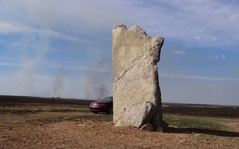
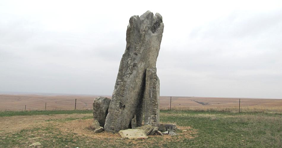
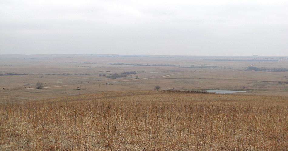
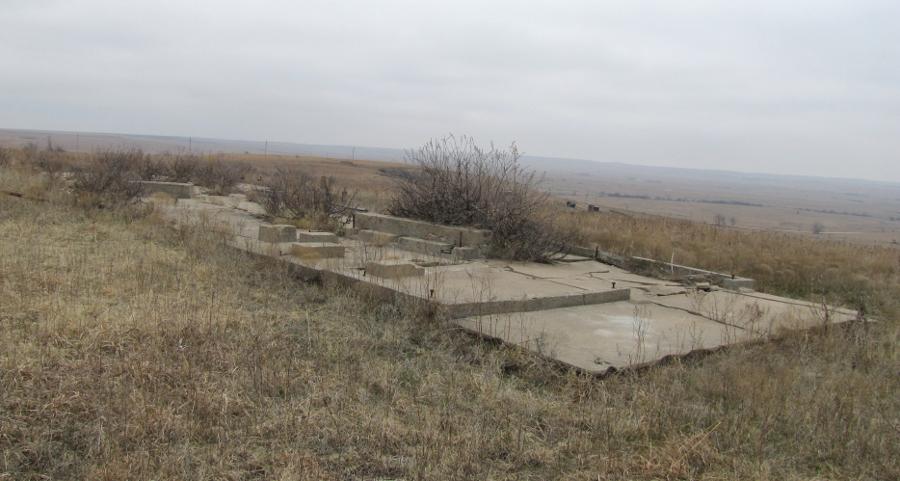
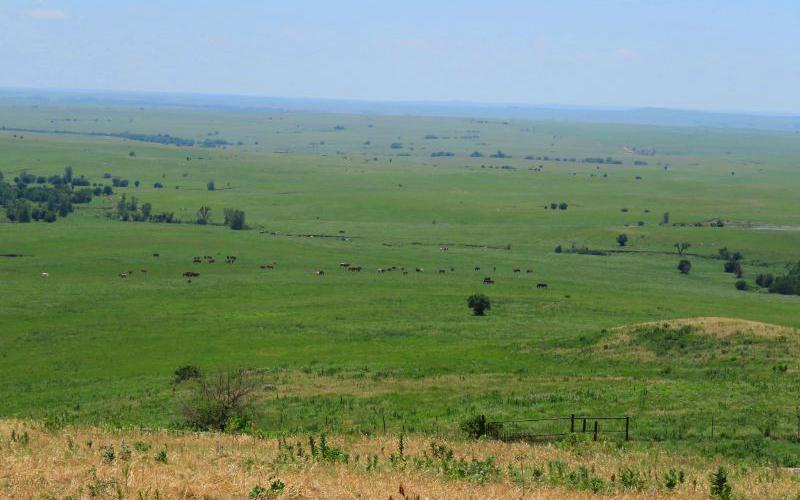
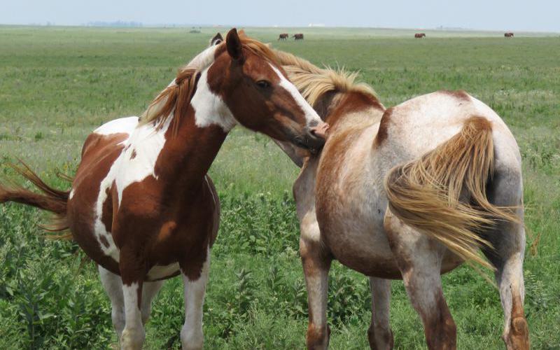
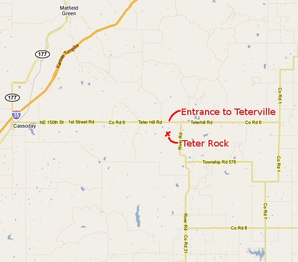
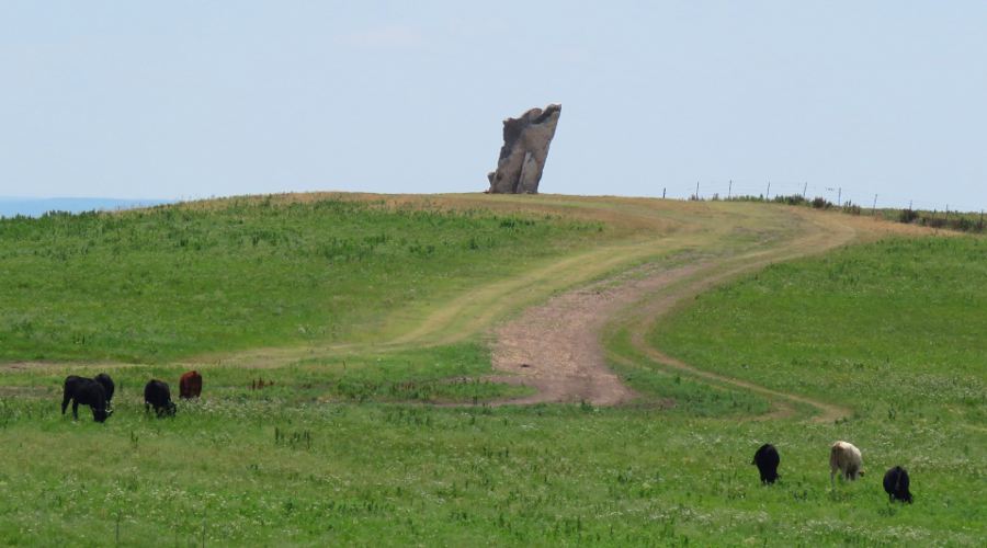
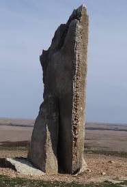
Teter Rock was a pile of local rocks which James Teter erected at a high point on his land as a guidepost for homesteaders searching for the Cottonwood River. As Teterville grew, the rocks were used in the construction of several of the buildings and the Teter marker disappeared. The Teterville community faded away as the Teter Oil Fields played out. Today a few foundations are the only part of Teterville which remains, but Teter Rock was reconstructed in 1954. A 16' slab of rocks was erected in honor of Mr. Teter. When the first of these photos were taken in March of 2011 the promontory that Teter Rock is located on was windy and felt very cold, yet the setting was starkly beautiful. The second visit was on a warm, sunny day in March of 2015 when range burning was taking place through the region. I've been back several times. On the way to Teter Rock, you may pass herds of wild horses maintained for the Bureau of Land Management by local ranchers. Wild horses can usually be seen in the distance from Teter Rock.
copyright 2011-2025 by Keith Stokes |
 Teterville,
Kansas was a small community which formed near
the Teter Oil Fields in southeast Kansas in the 1920s. The community was
named for James Teter who owned the land were the oil and homes were located.
Teterville,
Kansas was a small community which formed near
the Teter Oil Fields in southeast Kansas in the 1920s. The community was
named for James Teter who owned the land were the oil and homes were located.