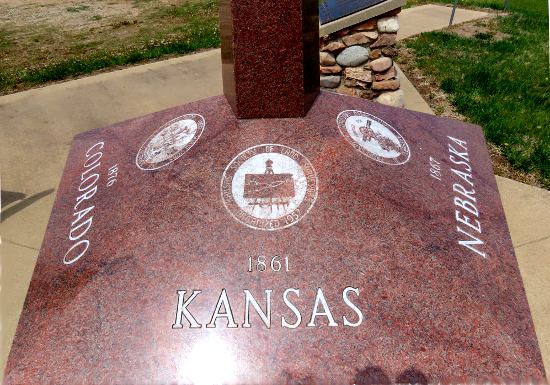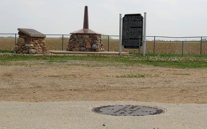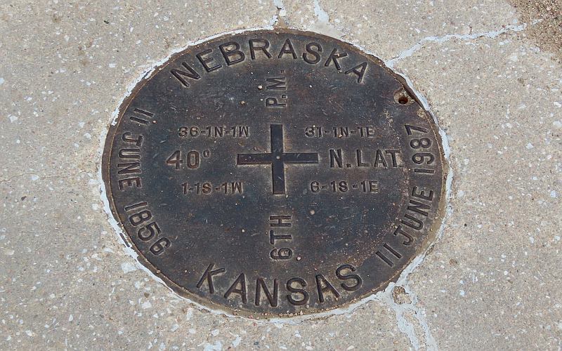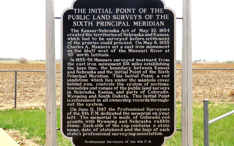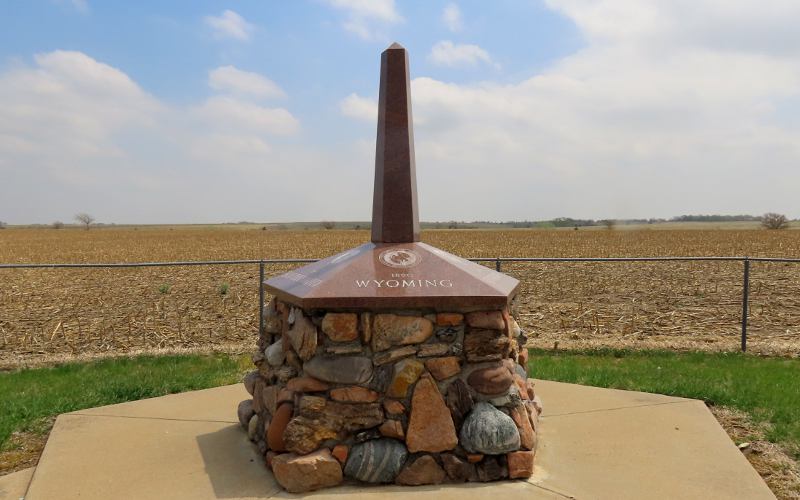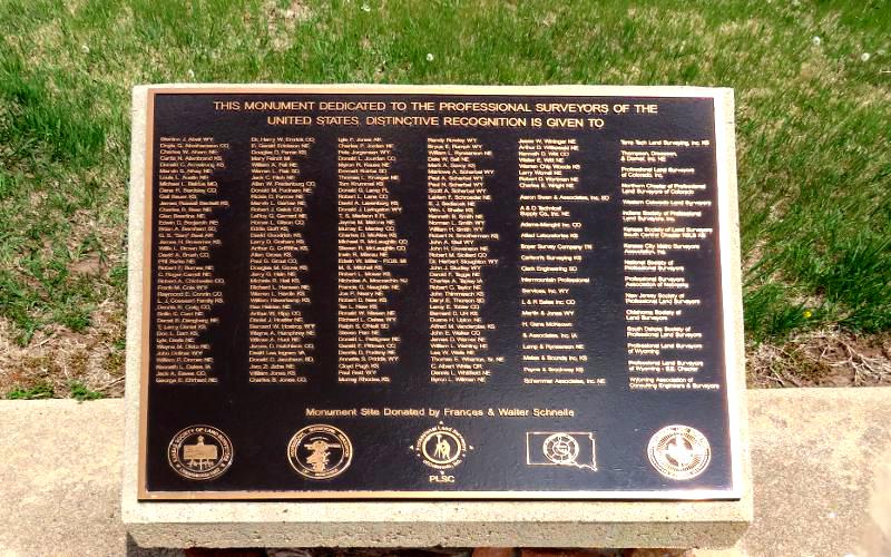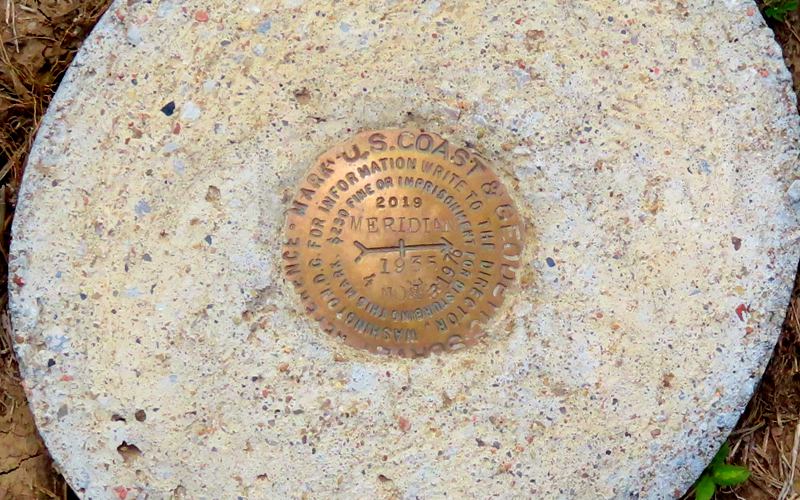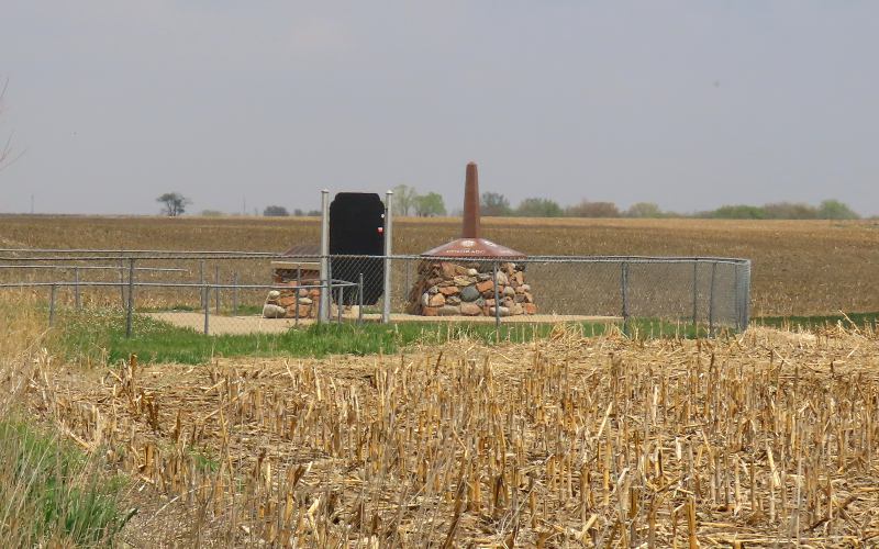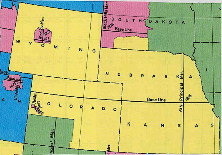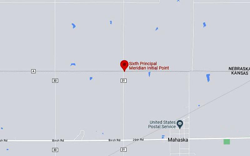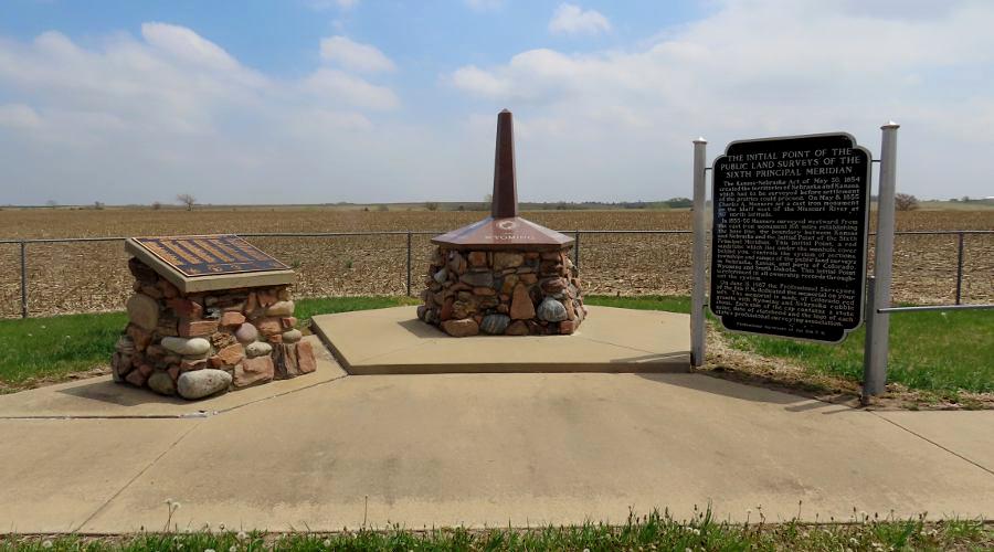
Sixth Principal Meridian Initial Point - Mahaska, Kansas The Sixth Principal Meridian Initial Point near Mahaska, Kansas was established in 1856 and was the initial point use to locate all land surveys in territories of Kansas & Nebraska. Today that area includes all of Kansas & Nebraska much of Colorado & Wyoming, and a small portion of South Dakota. There are several markers and monuments that were erected in the 1980s and the location reminds me of the Kansas, Nebraska, Colorado Tristate Point and the Kansas, Colorado, Oklahoma Tristate Point. In addition to a historic marker, there is a five sided monument listing the five states which were surveyed and a plaque honoring some of the professional surveyors within those five states. The actual surveyors stone is located in the road a little west of the moments, surrounded by a concrete pad, The stone is beneath the manhole cover. The Sixth Principal Meridian Initial Point was place 108 miles west of the 40th Parallel Marker in 1858.
40th Parallel Marker
copyright 2023-2024 by Keith Stokes |