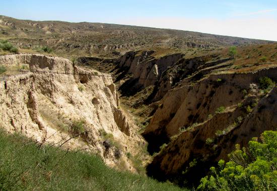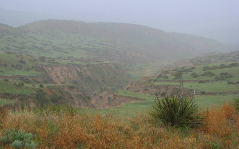
Arikaree Breaks from Lookout Point - self guided tour stop #11 The Arikaree Breaks are located on the extreme northern edge of Cheyenne County, in the northwestern corner of the state of Kansas. The breaks, with its deep ravines and gullies, is in marked contrast to the plains generally associated with the area. The breaks were formed by wind deposited sand, silt and clay particles, called loess. After deposition, the loess has undergone spectacular processes of head cutting and side wall cutting the advancing tributaries of the Arikaree River and the South Fork of the Republican River. The Arikaree Breaks are 36 miles long and approximately two to three miles wide. They extend into Rawlins county to the east and several miles into Colorado to the west. There are few trees in the rough terrain, but the pasture land has many yucca or soap weed as they are called by the natives. There are two species of sage that grow in the breaks that grow no other place in Kansas and 16 native plants that are listed as "rare" in Kansas. The hills are covered with native grasses, excellent for cattle and wild life. Water is hard to find in some areas so area ranchers have built dams to water their livestock. Wells are often drilled many miles away from the livestock and then piped into the area. There are over 20 miles of plastic pipe lines in use. There are several public roads through the breaks, giving visitors some outstanding viewing sites of this rugged wonder. Visitors are asked to please respect the land owners by remaining on the public roads.
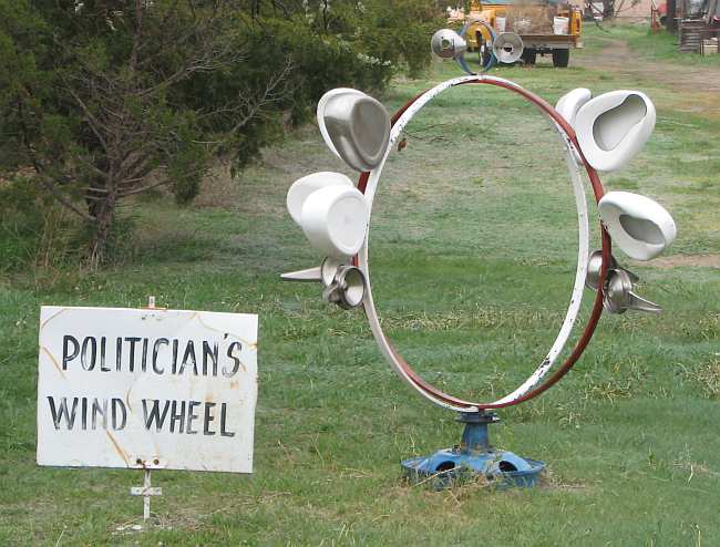
The Tour The original version of this tour is available from the St. Francis Area Chamber of Commerce or at the Cheyenne County Museum. This version draws heavily on that tour, with a few additions. This tour starts from the Cheyenne County Courthouse, 212 Washington, St. Francis, Kansas. The brick and limestone building was built in 1925. Drive north from the Court house on Benton Street. The first stop is on the right after about 2/3 of a mile. Here you will find the whimsical, welded metal sculptures made by the late Harvey Walz.
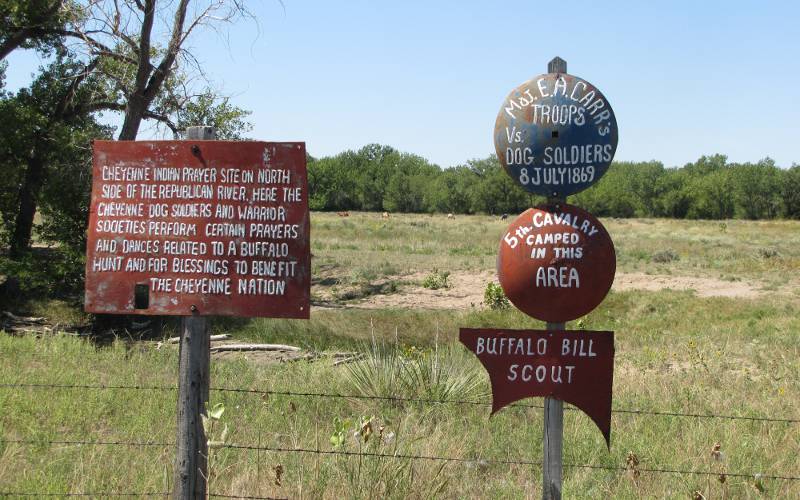
Just a few hundred more feet on the left, you will find markers indicating that the area along the Republican River was both used as a prayer site by Cheyenne Warriors and as a camp for the 5th Cavalry just before the Battle of Summit Springs in July 1860.
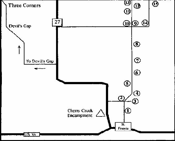
1. Which brings us to the first stop on the map above - the Republican River Bridge, one mile north of the Cheyenne County Courthouse. At the bridge you will find an entrance to the Republican River Walk, beautiful 3/4 mile walk paralleling the river. The other end is at River Street near the grain elevators. 2. At this red sign, take the right hand fork of the road (Parks Road) 3. G.A.R. Cemetery Turn east 1/4 mile. This cemetery was established in 1889. The east half was to be used exclusively for the burial of Grand Army of the Republic Comrades and their families. The west half was to be used for the burial of citizens and their families. No lots were to be sold; only a donation for the dead was taken. This provision was made to enable destitute Civil War veterans an honorable burial. NOTE: the cemetery is hard to find. 4. Spring Creek This creek is the first of four spring fed creeks on this tour. Spring Creek was a popular homestead site for the county's early settlers. 5. Stay on the main road, heading north. 6. Plum Creek This spring fed creek has wild plums growing along its banks. 7. Cleveland Run Creek was named after the township that it is in. It was also a popular homestead site with its running spring water.
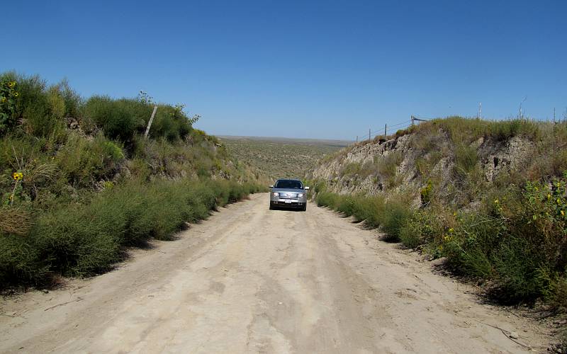
8. Hackberry Creek was the site of several Indian encampments. It is the longest of the creeks on this tour, starting one mile east of the Colorado border at the edge of the breaks. 9. Turn right here to visit Horse Thief Cave. This drive is not recommended in wet weather. Take County Road BB two miles east. 14. Turn left (north) on Country Road 17.
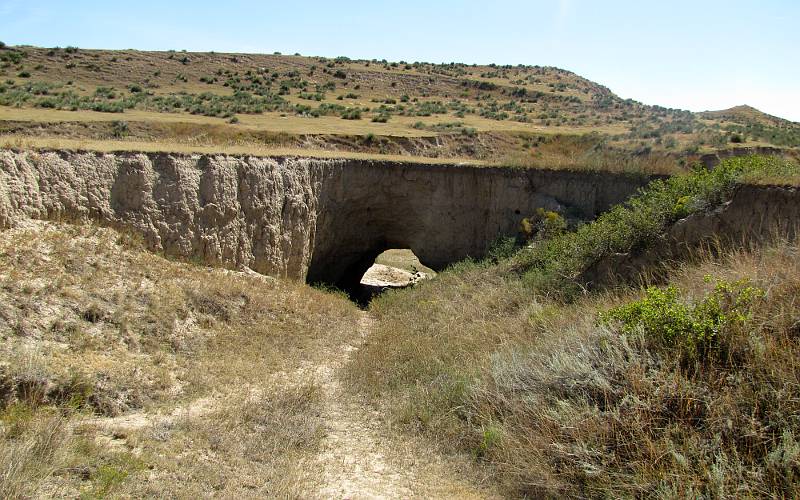
15. Horse Thief Cave This is one of several caves in the breaks.
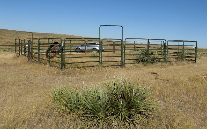
10. Return to where you left Parks Road, turn right on to what is now County Road 15 and continue north here to visit the breaks. 11. Beginning of the best views of the Breaks. 12. Down the road less than 1/4 mile from Lookout Point is a parking area. See the photo at the top ot this page. 13. Kansas/Nebraska State Line. You may continue north here, traveling to US 34, retrace your route to St. Francis, or continue west to K-27. From there you can turn south, traveling 5 miles to the turn off to Devil's Cap another outstanding view of the breaks.
copyright 2007-2017 by Keith Stokes |